Maps

NSW Maritime provides links to different types of maps for NSW waterways.
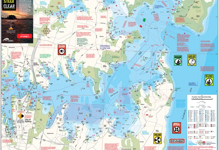
Boating maps
Boating maps are available for purchase for a nominal fee. They are a vital tool for negotiating NSW waterways and include handy hints for safe boating.
Boat ramps
Search for a boat ramp using their interactive map.
Hydrographic plans
NSW Maritime surveyors carry out hydrographic surveys of navigable waters including inland waterways, coastal rivers and entrance bars to support safe navigation, environmental monitoring and dredging works.
Mooring maps
View their mooring maps and find a suitable location to moor your vessel.
Wharf bookings map
A map of Sydney Harbour wharves required to be booked through the wharf booking system by commercial vessel charter operators.